If you’ve ever watched a sci-fi movie and thought, “Wow, I wish I could recreate my living room in 3D,” you’re in luck. The world of 3D scanning has been advancing at a warp speed, thanks to technologies like LiDAR and photogrammetry. But when it comes to choosing between LiDAR vs photogrammetry, the decision isn’t always straightforward. So, let’s embark on this 3D scanning comparison journey, shall we?
Understanding LiDAR Technology

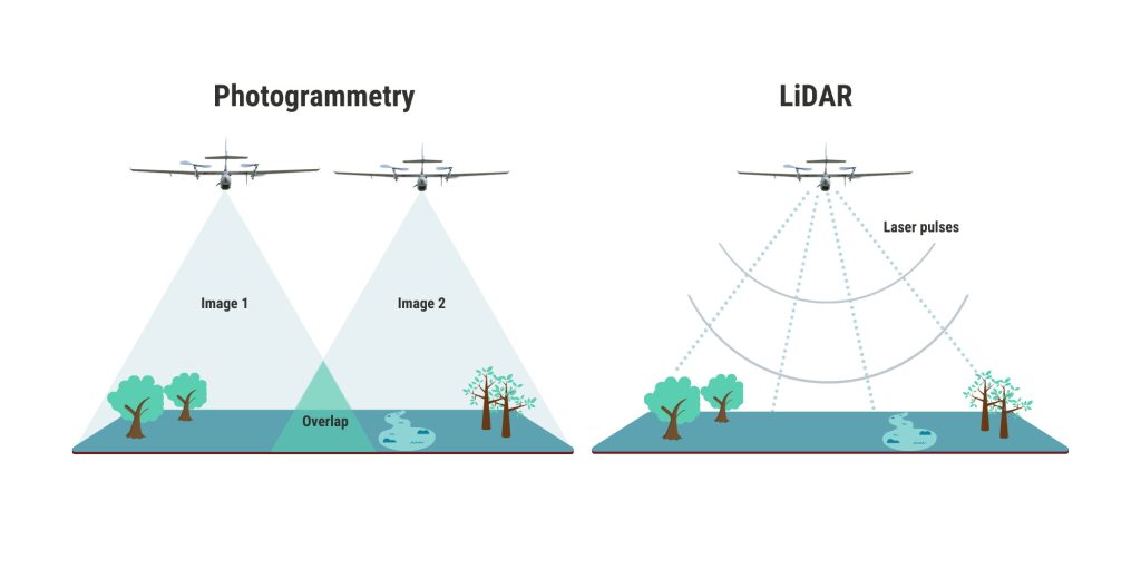
First, let’s dive into the realm of LiDAR, which stands for Light Detection and Ranging. This technology is like the superhero of 3D mapping, using laser light to measure distances and create incredibly detailed point clouds. It’s a bit like echolocation, but instead of bouncing sound waves, it uses light. The result? Highly accurate 3D models that are perfect for topographic mapping, terrain modeling, and even creating digital twins of objects or environments.
How LiDAR Works
LiDAR technology sends out laser beams that bounce back after hitting an object. The time taken for each beam to return is measured to calculate the distance. This data is then used to generate a 3D representation of the scanned area. It’s as if you have a tiny army of light soldiers mapping out every nook and cranny of your surroundings.
In terms of applications, LiDAR is a favorite in aerial scanning and remote sensing. It’s used extensively in geospatial analysis, helping urban planners, environmentalists, and engineers get a bird’s eye view of landscapes without the need for a helicopter ride (unless you’re into that sort of thing).
Delving into Photogrammetry
Now, let’s shift gears to photogrammetry. Unlike LiDAR, photogrammetry doesn’t rely on lasers. Instead, it uses a series of photographs taken from different angles to create 3D models. Think of it as the artful cousin in the 3D scanning family, using photography and a bit of magic to weave together detailed models.
How Photogrammetry Works
Photogrammetry involves capturing multiple images of an object or scene from various perspectives. These images are then processed using photogrammetry software to stitch together a 3D model. It’s a bit like creating a panoramic image, but on steroids. The software identifies common points in the images and uses them to construct a digital replica.
This method is particularly popular in survey technology and 3D reconstruction, offering a camera-based scanning approach that’s accessible and cost-effective. It’s a go-to for artists, architects, and anyone with a penchant for capturing the world in three dimensions.
LiDAR vs Photogrammetry: The Battle of Accuracy
When it comes to accuracy, LiDAR has a slight edge, especially in environments with complex geometries or poor lighting conditions. LiDAR accuracy is renowned for its ability to precisely capture data, making it a top choice for applications that demand high precision, such as GIS data collection and point cloud generation.
Photogrammetry accuracy, on the other hand, can be impressive but often depends on the quality of the images and the software used. It might struggle in low-light conditions or with reflective surfaces, but give it a clear day and a decent camera, and it can produce stunning results.
Choosing the Best 3D Scanning Method
So, which technology reigns supreme in the 3D scanning showdown? Well, it depends on your needs. If you’re looking for speed and precision, especially in aerial or large-scale mapping, LiDAR is your go-to. It’s like the Swiss Army knife of surveying—versatile and reliable.
However, if cost is a concern and you have time to process images, photogrammetry offers a more budget-friendly option. It’s like the friendly neighborhood artist, ready to capture the essence of a scene with just a camera and some clever software.
Considerations for Drone Mapping
Both LiDAR and photogrammetry have made significant strides in drone mapping. With drones becoming more accessible and affordable, both technologies offer unique advantages for capturing data from above.
- LiDAR on Drones: Provides high-resolution data and can penetrate through foliage, making it ideal for forestry and environmental studies.
- Photogrammetry on Drones: Offers a lightweight and cost-effective solution, perfect for capturing large areas quickly, provided lighting conditions are favorable.
Theoretical Insights: Remote Sensing and 3D Mapping
In the grand scheme of remote sensing, both LiDAR and photogrammetry contribute to the growing field of geospatial analysis. They allow us to map our world in ways previously thought impossible, turning data into actionable insights.
At the heart of this revolution is the concept of digital twins—virtual replicas of physical objects or environments. These twins are invaluable for urban planning, disaster management, and even virtual reality applications.
But before you rush to create a digital twin of your backyard, it’s worth noting that both methods have limitations. LiDAR can be more expensive, while photogrammetry might require significant processing time and power. It’s all about finding the right balance for your specific needs.
Practical Examples and Real-World Applications
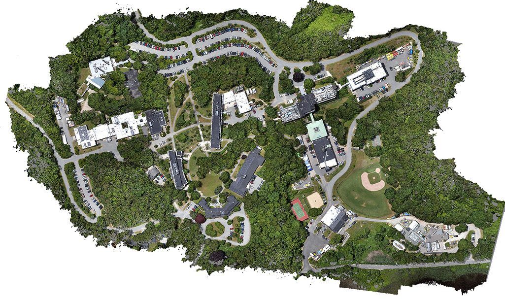
In the real world, 3D scanning has found its place in various industries. From archaeology, where ancient ruins are digitally preserved, to construction, where accurate site models streamline project planning, the possibilities are endless.
For those looking to get hands-on experience, consider investing in a versatile 3D scanner. It’s a fantastic way to dive into the world of 3D scanning, offering portability and ease of use.
So, there you have it—an epic showdown between LiDAR and photogrammetry. Each has its strengths and weaknesses, and the best choice depends on your unique requirements. Whether you’re mapping a dense forest or recreating a historic building, these technologies offer a glimpse into the future of spatial data collection. And who knows, maybe one day you’ll be scanning your living room for a virtual reality game night!